.
Introducing a dynamic network information system
Guard Cloud
Our solutions
Worth more than a thousand words
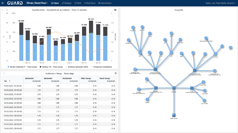
What is a network graph?
A network graph is a mathematical structure (graph) to show relations between points in an aesthetically-pleasing way. The graph visualizes how subjects are interconnected with each other. Entities are displayed as nodes and the relationship between them are displayed with lines.
This form of visualization can be applied to anything that has a logical relation. That is, the various steps in a manufacturing or treatment process, a supply chain, water distribution systems, waste water pumping stations, the electrical power grid, IT infrastructure and even social networks.
What is the difference between NIS and GIS?
The difference between NIS (Network Information System) and GIS (Geographical Information System) can sometimes be confusing. Our favorite analogy to explain the different use cases is navigating through a big city for sightseeing.
When arriving to an unfamiliar city, you will most likely have a hard time getting around without two different maps. The first is a city map (GIS) that gives you an understanding of where the different attractions are in terms of their geographical location. This comes in handy when navigating city streets by foot or in a car. However, as soon as you enter the subway, you will realize an urgent need for a second and vastly different map, namely the subway map (NIS). The subway represents a whole new dimension where the geographical location of your destination is no longer relevant. All you need to know is which line that will take you to your desired location. Subway systems are well-known for their beautiful network graphs that manage to visualize a complex infrastructure in an intuitive and simple manner. However, this would not be possible without being more or less decoupled from geography. Or, put differently: you do not need to know how the subway takes you where you want.
Therefore, many of our clients realize that, depending on the situation, both NIS and GIS are very helpful tools to stay on top of their operational control.